Windy Weather Brings Wet, Chilly Conditions Soon
If you’re into podcasts or in a rush, check out my daily weather update. Search for NewsOn6 and ‘Weather Out The Door’ on most podcast providers, including Spotify, Stitcher and Tune-In, or Click Here to listen on Apple Podcasts.
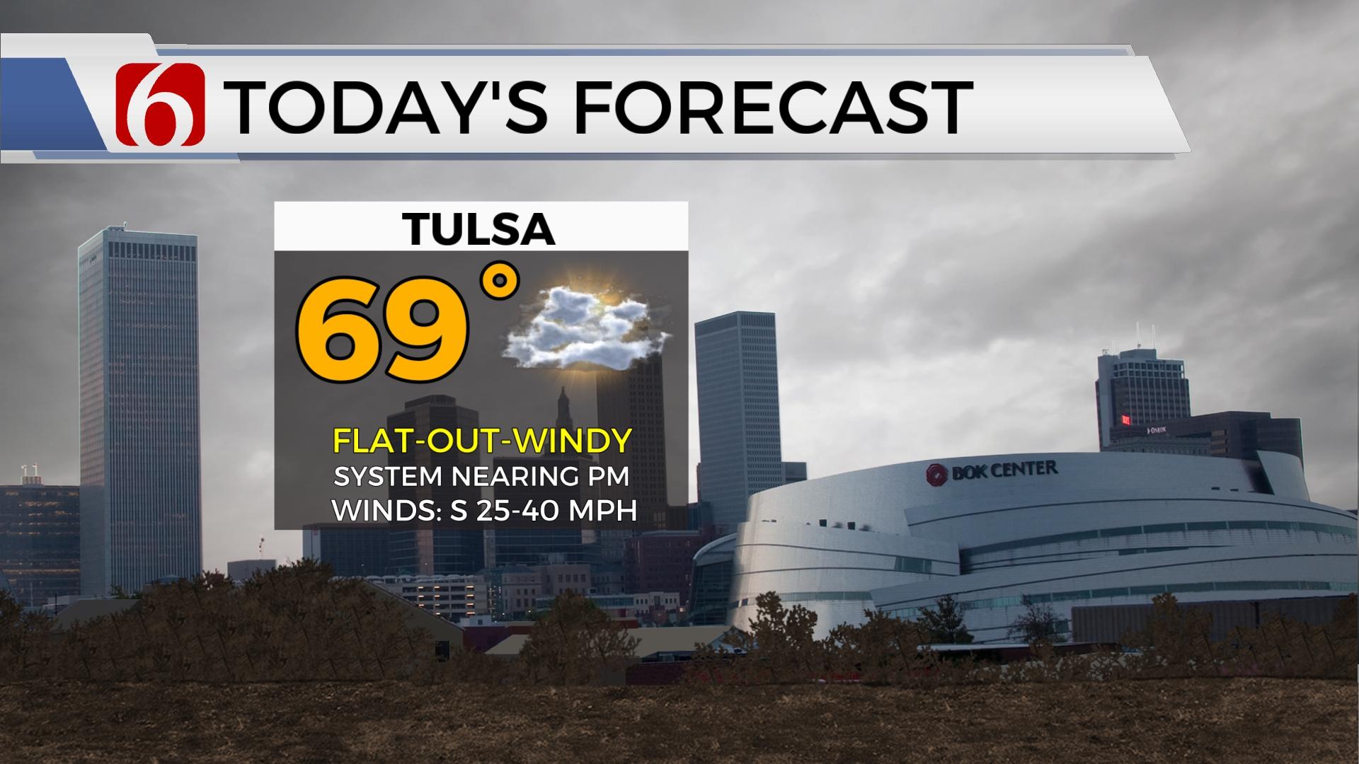
TULSA, Okla. - A mild and windy day is ahead before shower chances return to Green Country.
Here are the details from News On 6 Meteorologist Alan Crone:

Above normal highs return Monday, but with strong south winds and mostly to partly cloudy sky. A storm system arrives soon with increasing probabilities for rain and thunder. Some pockets of locally heavy rainfall will be possible with this system in some but not all locations for Tuesday and Wednesday. A fast-moving clipper arrives late Thursday evening into early Friday morning.

The first part of the system is Monday. Strong south winds from 25 to near 40 mph will be possible with morning to midday clouds and some afternoon sunshine. As the front nears the area later in th day, temperatures could jump into the upper 60s near or northwest of Tulsa and remain in the lower to mid-60s across southeastern Oklahoma. The front enters the area this evening with increasing rain and thunder chances as the boundary slides southeast. Rain chances will remain across part of the area Tuesday with potential for some locally heavy rain, mostly across far southeastern sections of the state. As the main upper-level trough pivots over the central plains, a swath of wintry mix will be possible, mostly from northwestern Oklahoma to south central Kansas Wednesday. We'll watch this period for any adjustments that could bring this area closer to north central Oklahoma.

Temperatures Tuesday and Wednesday will drop below normal with highs in the 40s and blustery northwest winds from 15 to 25 mph.

The next fast-moving system arrives late Thursday night into Friday morning. The track of this system has changed some in the data over the last week but seems to be converging across far northern OK and southern Kansas. The temperature profile will be cold enough to support some wintry conversion as colder air aloft with the trough arrives near the area. We'll continue with a low probability for some light snow during this period of the forecast. As the waves quickly moves away, warmer, and pleasant weather is likely to arrive Saturday before a dynamic storm system nears the state Sunday into early next week.
Thanks for reading the Monday morning weather discussion and blog.
Have a super great day!
Alan Crone
KOTV